


Punjab Sets New Milestone in Land Record Digitization Using Drone Technology
Punjab, Pakistan has created history in land administration by successfully digitizing over one crore (10 million) households through advanced drone mapping technology, marking a major breakthrough in the province’s land record system.
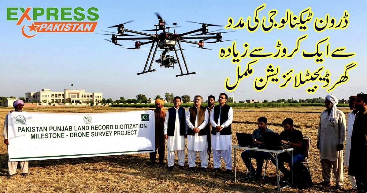
According to an official statement shared by the Punjab Government, drone-based digital mapping has so far been completed in 6,442 revenue estates, transforming how land ownership data is recorded, verified, and protected.
Drone Technology Transforms Punjab Land Records
The use of high-resolution drone technology has enabled authorities to develop accurate, layered digital maps of land parcels across Punjab. These maps integrate aerial imagery with official revenue records, ensuring greater precision than traditional manual surveys.
This modern approach significantly helps in:
-
Reducing land ownership disputes
-
Preventing illegal land encroachments
-
Ensuring transparency in property records
-
Protecting citizens’ ownership rights
Over 10 Million Homes Digitally Mapped
With more than 10,776,000 households digitally mapped, Punjab has emerged as a leader in land record digitization in Pakistan. Officials say this achievement empowers citizens by providing tamper-proof and easily verifiable land data, which was previously prone to manipulation.
Digital land mapping also improves access to property information for buyers, sellers, banks, and government institutions, making transactions faster and more reliable.
Major Step Toward Transparent Governance
This initiative is part of Punjab’s broader governance reforms aimed at improving public service delivery through technology. By digitizing land records, the government seeks to eliminate corruption, reduce litigation, and strengthen public trust in state institutions.
Experts believe the project will also support:
-
Urban and rural development planning
-
Infrastructure expansion
-
Fair taxation systems
-
Investment and economic growth
Punjab Leads Pakistan in Digital Land Reforms
The drone-based land record initiative positions Punjab as a pioneer in digital land governance, setting a model for other provinces to modernize their land administration systems.
Officials reaffirm that the project will continue expanding until complete province-wide coverage is achieved, ensuring long-term benefits for citizens and future generations.
